An experimental satellite has revealed the vast scale of GPS jamming across Europe and the Middle East, exposing widespread signal interference.
The findings provide one of the clearest views yet of how widespread navigation signal disruption has become. The data also shows that the problem affects not only aircraft and ground users but satellites operating hundreds of kilometers above Earth.
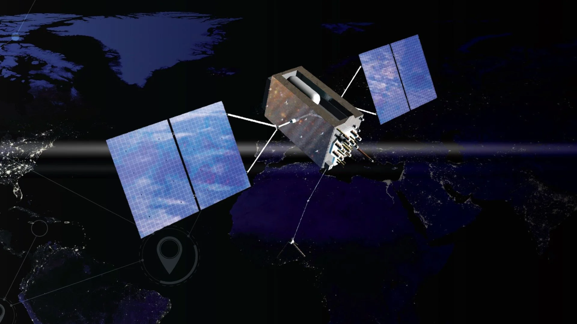
The measurements were collected by Pulsar-0, a test satellite operated by California-based Xona Space Systems. The spacecraft was launched to demonstrate technology for a future navigation network in low Earth orbit. It is currently orbiting the planet at an altitude of about 500 kilometers.
The satellite carries equipment designed to test Xona’s planned navigation service. It also includes a GPS receiver that allows engineers to compare existing navigation signals with the company’s new system. Shortly after activating the receiver, researchers noticed unexpected signal disruptions over large areas of Europe and the Middle East.
According to the company, the amount of interference was greater than anticipated. Engineers expected to detect some level of jamming because of ongoing conflicts and security activities in several regions. However, the scale and intensity of the disruption surprised the team.
Global Positioning System(GPS) is one of several satellite navigation networks used around the world. Similar systems include Europe’s Galileo network and China’s BeiDou system. Together, these systems provide positioning, navigation, and timing services that support modern infrastructure.
These signals are used in many industries every day. Airlines depend on them for navigation and route planning. Financial institutions use precise timing signals for transactions, while power grids, telecommunications networks, shipping operations, and energy companies also rely on accurate positioning and timing data.
Traditional GPS satellites operate at altitudes of more than 19,000 kilometers above Earth. Because the signals travel such a long distance, they arrive at receivers with relatively low strength. This makes them vulnerable to interference from powerful ground-based transmitters.
READ ALSO: Texas A&M Researcher Advances Cold Battery Technology for Space and EV Applications
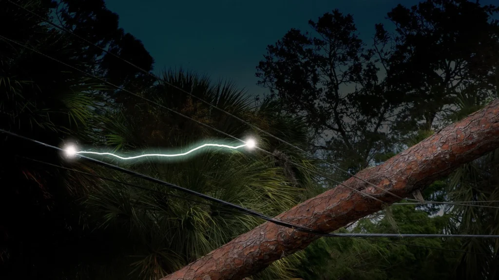
GPS jamming works by overwhelming legitimate signals with radio noise. When this happens, receivers struggle to accurately determine their position. In severe cases, they completely lose navigation capability.
Another growing threat is GPS spoofing. Instead of blocking signals, spoofing replaces genuine navigation data with false information. This can mislead receivers into calculating incorrect positions, directions, or times.
Over the past several years, both jamming and spoofing incidents have increased significantly. Security experts have reported rising levels of interference in regions affected by military tensions and armed conflicts. These disruptions now affect civilian transportation, commercial operations, and satellite services.
One major hotspot is near Russia’s western borders. Authorities and military operators in the region have used electronic systems to interfere with navigation signals. Aviation organizations have reported that thousands of flights experience GPS disruptions every month while traveling through affected airspace.
The Middle East has also become a major area for navigation interference. Military forces and armed groups use jamming and spoofing systems to counter drones and conceal movements. Maritime authorities have documented incidents in which ships appeared to be in incorrect locations due to manipulated navigation signals.
GPS Jamming Reaches Orbit
The new measurements from Pulsar-0 indicate that the effects extend much farther than previously understood. Signal degradation was detected across a vast region stretching from France in Western Europe to areas near Pakistan in South Asia. This suggests that interference can influence satellite operations across a significant portion of low Earth orbit.
Researchers found that signal strength dropped sharply in some locations. Under normal conditions, the satellite detected GPS signals at around 40 decibels. In heavily affected areas, signal levels fell to roughly 10 decibels.
Such reductions can create operational challenges for satellites. Many spacecraft use GPS to determine their location and maintain accurate timing. These functions are essential for mission planning, communication, and navigation.
Earth observation satellites are among the systems that depend heavily on accurate positioning. They must know their exact location before capturing images of specific targets. Reduced GPS performance can make this task more difficult.
Communication satellites also rely on navigation data. Without accurate positioning information, maintaining links with ground stations becomes more complicated. Operators may face challenges when pointing antennas or coordinating network activities.
READ ALSO: GT50 Engine Passes Combustion Tests as Full Prototype Assembly Prepares to Begin
Large satellite constellations also depend on navigation signals. Companies operating hundreds or thousands of spacecraft use positioning data to manage traffic and reduce collision risks. Reliable navigation is therefore important for the long-term safety of crowded orbital environments.
The findings demonstrate that satellites in low Earth orbit are not immune to interference generated on the ground. For many years, GPS disruption was largely viewed as a problem affecting aircraft, ships, and land vehicles. The new data shows that space-based systems can also experience significant impacts.
The issue is not limited to deliberate interference. Natural events can also disrupt navigation signals. Solar storms can disturb Earth’s upper atmosphere and affect the radio signals used by satellite navigation systems.
A major example occurred during the Gannon solar storm in May 2024. The event disrupted navigation services across parts of North America. Some precision agriculture systems were unable to operate properly for several days because of degraded positioning accuracy.
These challenges have increased interest in alternative navigation technologies. Governments and private companies are exploring backup systems that can provide reliable positioning and timing when traditional satellite navigation networks are disrupted. The goal is to reduce dependence on a single source of navigation data.
Xona Space Systems is developing one such solution. The company plans to deploy a constellation of about 300 satellites in low Earth orbit. Unlike traditional navigation satellites, these spacecraft will operate much closer to Earth.
Because they are closer, the signals they transmit will be much stronger. Company officials say the navigation signal from the future Pulsar network will be about 100 times stronger than conventional GPS signals. Stronger signals are harder for jammers to overpower.
According to the company, this stronger transmission would significantly reduce the area affected by interference. Existing jamming systems would cover a much smaller radius. Users would therefore experience fewer disruptions in regions where interference is common.
Xona recently secured substantial financial backing to accelerate development of the network. The company raised $170 million during a funding round completed in March. The investment will support satellite manufacturing and deployment activities.
The next stage of the project is scheduled for later this year. Xona plans to launch six additional satellites in October. These spacecraft will expand testing and begin building the foundation of the future constellation.
The company expects early timing services to become available before the full network is completed. Initial customers are expected to begin using intermittent coverage as more satellites enter orbit. Service quality will improve as additional spacecraft are launched.
WATCH ALSO: Swiss company’s new ‘brain’ to help robots conduct real-life tasks autonomously
The new findings arrive at a time when reliance on satellite navigation continues to grow worldwide. From aviation and shipping to banking and telecommunications, critical sectors depend on accurate positioning and timing every day.
As GPS interference becomes more widespread, ensuring reliable navigation services is becoming a strategic priority for governments, businesses, and satellite operators alike. The data collected by Pulsar-0 offers an important warning about the challenges facing current navigation systems. At the same time, it highlights the growing push toward stronger and more resilient alternatives.