

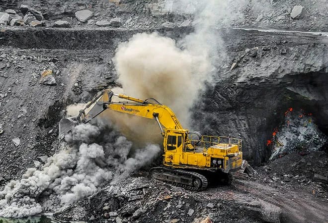
China has introduced two artificial intelligence systems designed to speed up geological mapping and mineral exploration.
The systems can process large volumes of geological information and support tasks that traditionally require extensive work by specialist teams. According to test data presented by Chinese authorities, one mineral evaluation process that once took about six months can now be completed in one week.
The China Geological Survey, under China’s Ministry of Natural Resources, unveiled the systems at the 28th China Mining Conference and Exhibition in Tianjin.
The conference concluded on Saturday, with the two systems making their global debut at the event. They are called AI-GeoMapping and AI-OreSeeking.
AI-GeoMapping is designed to change how regional geological surveys are carried out. It combines big data, artificial intelligence and other digital technologies to process information gathered from space, the air and the ground. The system then brings these different data sources together to support geological analysis and map production.
READ ALSO: https://modernmechanics24.com/post/romulus151-unmanned-ship-hull-completed/#google_vignette
The system covers the survey process from early research and data collection to geological interpretation and map compilation. It also supports field data collection, data management, analysis and the presentation of survey results. By placing AI-based mapping across the workflow, it reduces the amount of manual processing required at different stages.
Faster Mapping With AI
AI-GeoMapping has recorded an overall accuracy of more than 90 percent in identifying geological bodies, according to the China Geological Survey.
It has also increased the efficiency of data processing, combined analysis and geological map compilation by more than 50 percent. These functions are intended to help survey teams handle large amounts of information in less time.
The system has been tested on nearly 100 geological map sheets at a scale of 1:50,000. The trials covered Qinghai, Xizang, Xinjiang, Fujian and other provincial-level regions in China. The technology has also been applied in countries including Morocco, Saudi Arabia and Laos.
The 1:50,000 scale means that a geological map represents an area in considerable detail while still covering a wide region. Such maps are used to understand rock formations, structures and other geological features that can guide further field investigations. AI-based processing gives survey teams a faster way to combine information from several sources before detailed work begins.
AI-GeoMapping also changes how geological information is handled during a survey. Instead of treating data collection, interpretation and map preparation as separate stages, the system links them through one digital workflow. This allows information generated at one stage to be used more directly in later stages.
AI Targets Mineral Deposits
The second system, AI-OreSeeking, focuses on mineral exploration. Traditional exploration depends heavily on geologists and other specialists examining information from many different sources before deciding where additional work is needed. AI-OreSeeking uses geological data, expert knowledge, exploration models and more than 200 data-processing and analysis algorithms to automate much of that process.
The system uses millions of entries in geological knowledge graphs. These records cover geological settings, mineralisation patterns and models of mineral deposits. It also processes geological, gravity, magnetic, electrical, geochemical and remote-sensing information to identify patterns linked to possible mineral resources.
In simple terms, the system brings different types of geological evidence into one analysis process. It can extract important mineralisation information and identify areas that have geological conditions suitable for further investigation. It can then help generate exploration targets and assess their potential.
AI-OreSeeking supports three working modes. Users can choose an expert-led approach, a largely automated process or a model in which geologists and AI work together. This allows exploration teams to decide how much control specialists retain during different stages of a project.
From Months To Days
The system can integrate data, identify potential mineralised areas and produce several types of exploration material.
Its functions include three-dimensional geological modelling, resource prediction assessments, professional maps and evaluation reports. These outputs are intended to help geologists decide where further exploration, including drilling, should take place.
WATCH ALSO: https://modernmechanics24.com/post/nvidiaai-general-purpose-humanoid-robot/
Testing has produced a significant reduction in processing time. Data presented by the China Geological Survey showed that mineral prediction and evaluation work that previously required about six months was completed in one week using the AI-OreSeeking system.
A gold exploration project in the western Qinling region provided a specific test case. AI-OreSeeking processed multiple sources of geological data and completed prediction and evaluation work for 32 map sheets at a 1:50,000 scale in five days. The system identified two gold exploration targets and four favourable areas for additional prospecting during the exercise.
The result demonstrates how AI can assist with large-scale exploration work. Instead of examining every area with the same level of attention, exploration teams can use the system to narrow the search to locations with stronger geological indicators. Geologists can then focus field investigations and drilling on selected targets.
Wider Mineral Exploration
AI-OreSeeking is designed for more than gold exploration. The system can be used for the exploration and assessment of several solid minerals, including iron, copper, aluminium, lithium, cobalt, nickel, lead, zinc, chromium, potash and uranium.
The system incorporates decades of mineral exploration experience from the China Geological Survey. It has five main functions covering geological and mineral data management, knowledge management, data processing and interpretation, AI-based prediction and assessment, and a large-scale AI model for mineral exploration.
The system has already been tested across more than 100 projects in more than 10 provincial-level regions in China. Trial locations include Xizang, Xinjiang, Fujian, Shandong and Inner Mongolia. These deployments have provided the geological survey authority with experience in applying AI to different exploration conditions and mineral targets.
The systems address a growing technical challenge in mineral exploration. Modern geological surveys produce information from satellites, aircraft, ground surveys, laboratory analysis and other sources. Combining these datasets manually can take substantial time, especially when large areas need to be assessed.
AI tools provide a way to process these datasets more quickly. They do not remove the need for geological expertise, since specialists still have to assess targets and decide how field exploration should proceed. Instead, the systems are designed to give experts faster access to analysed information and potential areas of interest.
The development also has an international dimension. China Geological Survey officials said the two systems are intended to provide a technical reference for the wider digital transformation of mineral exploration. Their use outside China in countries such as Morocco, Saudi Arabia and Laos also provides an early indication of how the technology can be applied to geological work in different regions.
READ ALSO: https://modernmechanics24.com/post/china-ai-robot-perform-heart-surgery/
Ren Xiaomai, an official with the China Geological Survey, said at the conference that the systems are expected to support the intelligent transformation of global mineral exploration.
The agency also said the technologies can contribute to further development in geological survey methods. Their international use will depend on factors such as local geological data, survey standards and how exploration teams integrate AI into existing workflows.
The launch places faster data analysis at the centre of China’s latest approach to mineral exploration. AI-GeoMapping focuses on geological surveying and map production, while AI-OreSeeking focuses on identifying and assessing potential mineral resources.
As both systems move from trials toward wider use, their performance across different geological environments will determine how broadly these methods can influence mineral exploration worldwide.












One Response